This vision is in the result of the work developed between 2010 and 2012 in Brussels in 2040 , looking vision sponsored by the Brussels -Capital RER area. In this context, the valley of the Woluwe is one of the strategic areas for future metropolitan Brussels .
It has fantastic landscape features , urbanity magnifying the capital, between contrasting rustic areas and build infrastructure and equipment of local and supra- local scales .
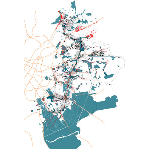
The valley of the Woluwe is a very important tributary of the Seine and has a double character which is directly related to its location on the border between two regions. Indeed years the Brussels-Capital, where the Woluwe its source , it flows into a fairly authentic landscape transformed into a rich green spaces and open structure determinant in this part of the city.
In contrast, the Woluwe valley is much more constrained in its most remote part of the city , in the Flemish Region . This is an incredibly dense immediate infrastructure presence causes : the airport, R0, Boulevard de la Woluwe, etc. Furthermore , additional infrastructure is provided , which clearly reveals the urgent need for a comprehensive vision for the whole valley. Since this valley is in fact partly loss (sometimes literally) and within the scope of a development by accumulation of small process. This means that ongoing projects and existing operations are increasingly under the influence of physical conditions in an artificial environment , such as floods and lack of quality open spaces. The landscape of agricultural areas is threatened by the tendency to fill these open areas by new developments. The strategy to be adopted is however not that filling. We must consider how these areas are critical to the landscape and livability of this part of the valley of the Woluwe. However, these areas must be better integrated into the metropolitan life and the banks of the Woluwe. This can be done through agricultural transverse structures related to structural features of the river. Often , these areas face a monofunctional planning business lands that may yet become permeable through the introduction of a common structure. Around the structures, ' patches ' can be densified. The strategy followed here is that of the dune setting common structure for the valley and activities that develop , allowing percolation and strengthening ecological continuity while describing a valley landscape fighting against his artificial environment. |